
Flame Zone
The BAL is in

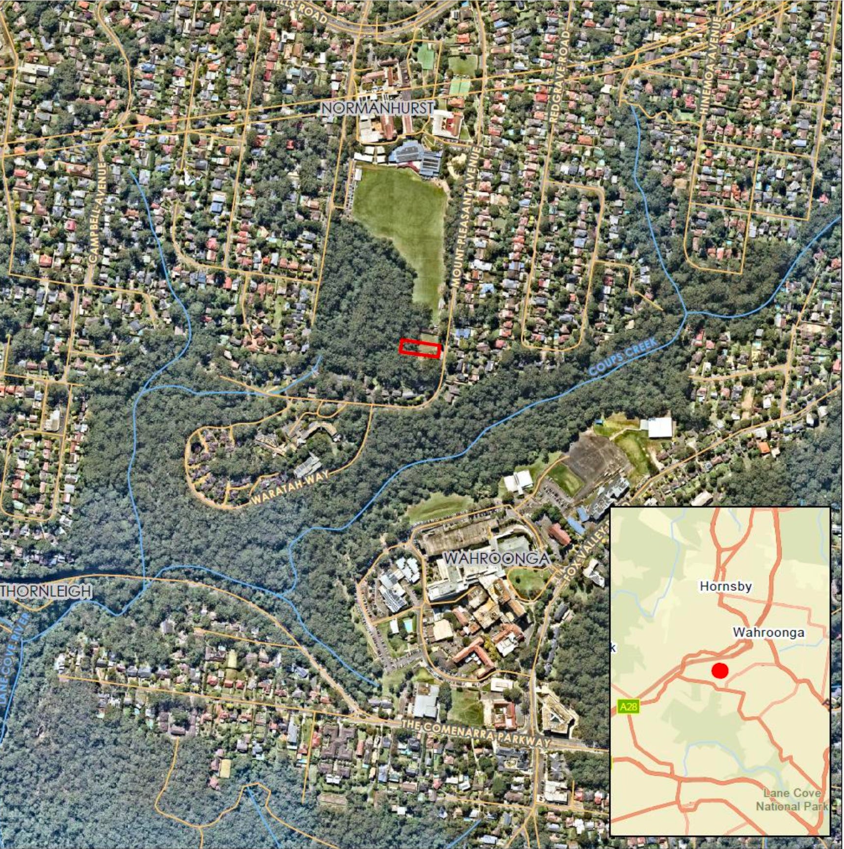
As regular readers might remember, I’ve been a teensy bit obsessed from early on about the BAL—the ‘Bushfire Attack Level’ of the block. Ever since I found out it was a thing, I’ve been concerned that my new house might be sited in a high risk bushfire space, because the rear of the block is a stand of Sydney Turpentine Forest—protected, and flammable.
The BAL is in
We’re required to provide Council with a Bushfire Report because ‘the site is identified as ‘bush fire prone land’ for the purposes of Section 10.3 of the EPA Act and the legislative requirements for building on bush fire prone lands are applicable.’
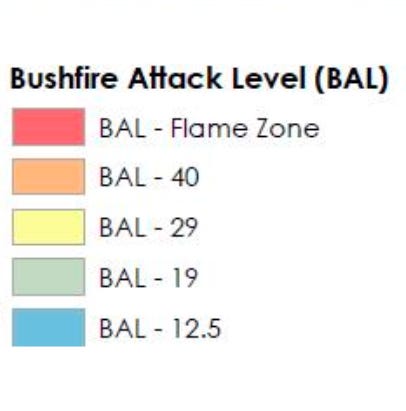
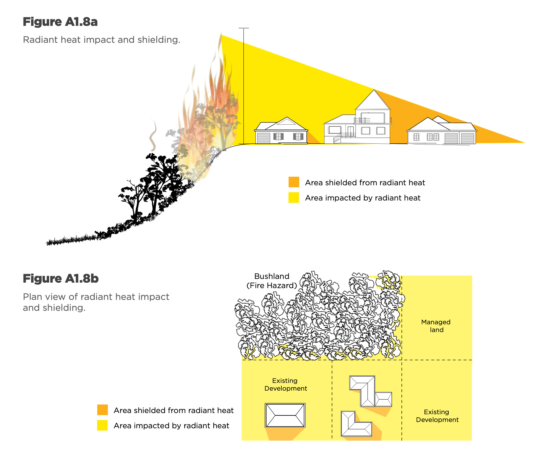
Now we’ve received a Bushfire Assessment Report from a Bushfire Consultant, and it’s official: half my block has the highest BAL rating: Flame Zone. Then there’s a transitional section rated BAL40, and most of the house will be in a BAL29 area.
The report explains:
‘The BAL assesses the severity of a building’s potential exposure to ember attack, radiant heat and direct flame contact, using increments of radiant heat expressed in kilowatts per square metre, which is the basis for establishing the requirements for construction to improve protection of a building from potential attack by a bushfire, as defined in Australian Standard AS 3959-2009 Construction of buildings in bushfire- prone areas (AS 3959-2018).
The BAL ratings are used as the basis for establishing the requirements for construction to improve protection of a building from potential bushfire attack.’
What does this mean?
The Bushfire Assessment Report also includes recommendations. Don’t worry! It’s possible to build on such a block, we just have to comply with regulations, and be careful about a few things.
We plan on using fireproof materials at the rear of the house, such as brick and steel cladding. Our SIP structure will be encased in things that don’t easily burn. The roof will be Colorbond steel. Appropriate windows will have to be considered.
It will come down to detail, and complying with the relevant regulations:
‘Construction must comply with the corresponding Bushfire Attack Level (BAL) as shown in Figure 6. The application of each BAL is as defined in Figure 6 and not broadly applied across the entire elevation/building. The construction must comply with corresponding sections of the Australian Standard AS3959-2018 Construction of buildings in bush fire-prone areas.’
But we have several BAL ratings across the site
‘From a practical compliance perspective, the highest BAL will be applied to any element of construction (i.e. window or roof) which is identified as having a split rating.’
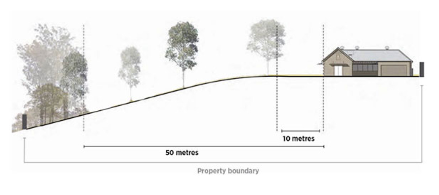
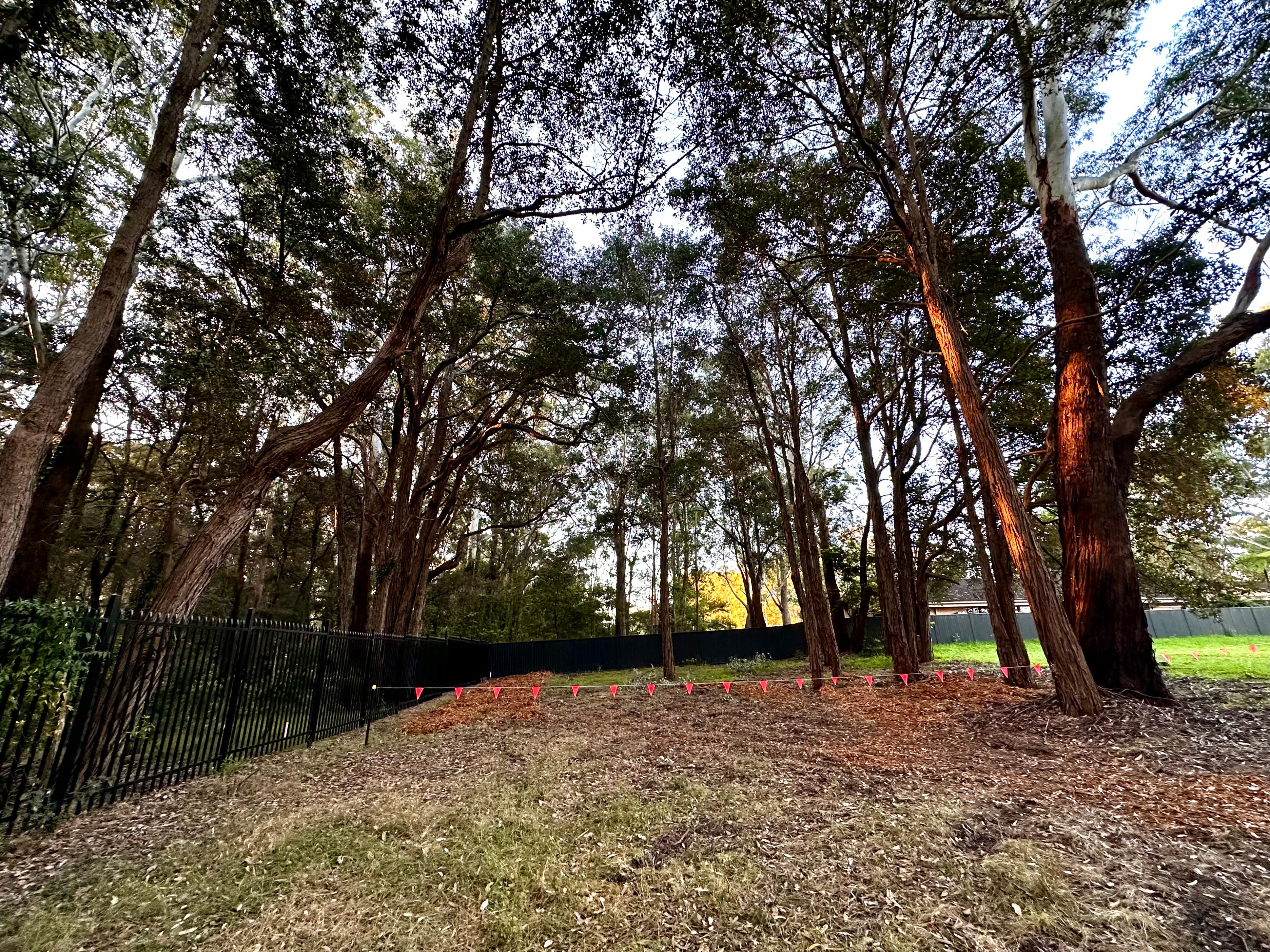
Landscaping
Reducing bushfire risk is not only about the building. The whole site is to be an Asset Protection Zone (APZ) and ‘Landscaping within the required asset protection zone must comply with Appendix 4 of Planning for Bush Fire Protection 2019.’
Something else to research. This is sure to include a recommendation, if not an actual requirement, to avoid the tree canopy overhanging the house.
There are only a few trees of any size on the block. The biggest is 30m high with an 11m canopy. Let’s hope it can stay.
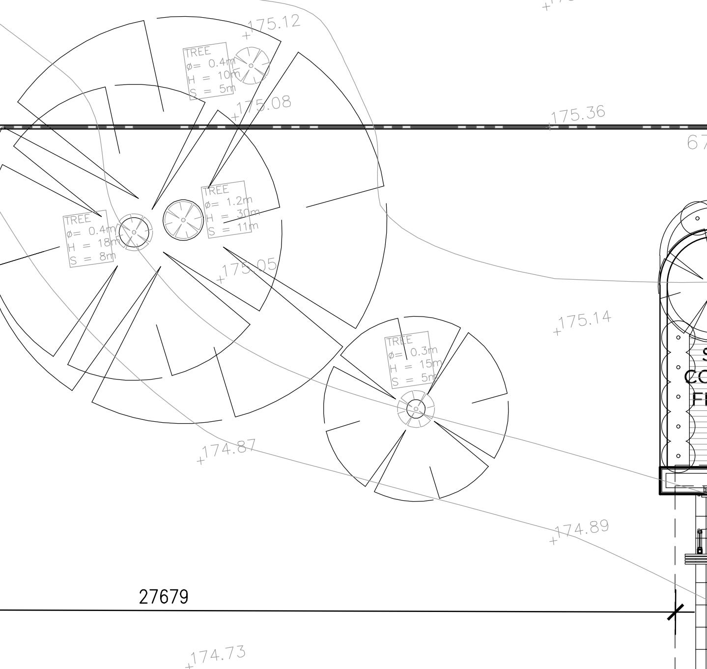
My trees - can they stay?
The ‘effective slope’
The consultant also reported on the risks of bushfire approaching from sloping land nearby:
‘The ‘effective slope’ influencing fire behaviour approaching the sites has been assessed in accordance with the methodology specified within PBP [Planning for Bushfire Protection, a NSW Rural Fire Service document]. This is conducted by measuring the worst-case scenario slope where the vegetation occurs over a 100 metre transect measured outwards from the development boundary. The effective slope to the west ranges from 2.3o to 4.6o downslope. The vegetation to the south and southeast is 17.5o downslope.’
Not my site: example from ‘Planning for Bushfire Protection’, NSW RFS
Radiant Heat Modelling
Radiant Heat Modelling is a tool used to predict the expected radiant heat transfer from fires to the surroundings and between buildings. The Consultant considered ‘the western and northwestern scenarios which present as the likely worst case bushfire scenarios for the site.’
While it’s confronting to read about the possibility of one’s yet-to-be-built house burning down, I try to remember that these are presented as ‘worst case scenarios’—and I’ll likely be long gone if there’s a fire in that bush in Fox Valley.
West Fire Scenario – The reasonable worst-case scenario is a fire run from the west which burns towards the site through the isolated area of Northern Hinterland Wet Sclerophyll Forests. This will burn on a 4.6 degree slope up towards the site.
Northwest Fire Scenario – The reasonable worst-case scenario is a fire run from the northwest which burns towards the site through the isolated area of Northern Hinterland Wet Sclerophyll Forests. This will burn on a 2.8 degree slope up towards the site.
Not my site: example from ‘Planning for Bushfire Protection’, NSW RFS
Consultant’s Conclusions
After giving various tables of requirements, all with a ‘tick’ or a ‘yes’ the Bushfire Report concludes ‘This assessment has demonstrated that the proposed new dwelling can comply with Planning for Bush Fire Protection 2019.’
So we just have to follow the rules.
What about the writing shed?
Those who read about the proposed writing shed might wonder about that little cabin snuggled into the back bush corner of the block. We’ll have to wait on approvals, but apparently no-one is likely to care if the shed burns down. As long as no-one can live in it.
The shed site. Might burn down. Worst case scenario.
Risks remain
All of this comes with a warning:
‘Bushfire is a normal part of Australia’s natural environment, particularly in eucalypt forests and grasslands. However, the frequency and intensity of bushfires varies throughout the landscape and the seasons. Bushfires are a common occurrence during the drier periods of the year in most places. Climate change is expected to bring longer bushfire seasons to parts of Australia, an increasing number of extreme fire weather days, and increasing fire intensity.
‘Due to certain limitations, the measures contained in this document do not guarantee that loss of life, injury and/or property damage will not occur during a bush fire event. Limitations of this document include, but are not limited to uncertainties in the following areas: • Fire Danger Index • fuel loads • existing developments • human behaviour • maintenance.
Reading all this, it’s hard not to think back to the terrible fires of the summer 2019/2020
I’m heading off now to consult those regs in Planning for Bush Fire Protection 2019.
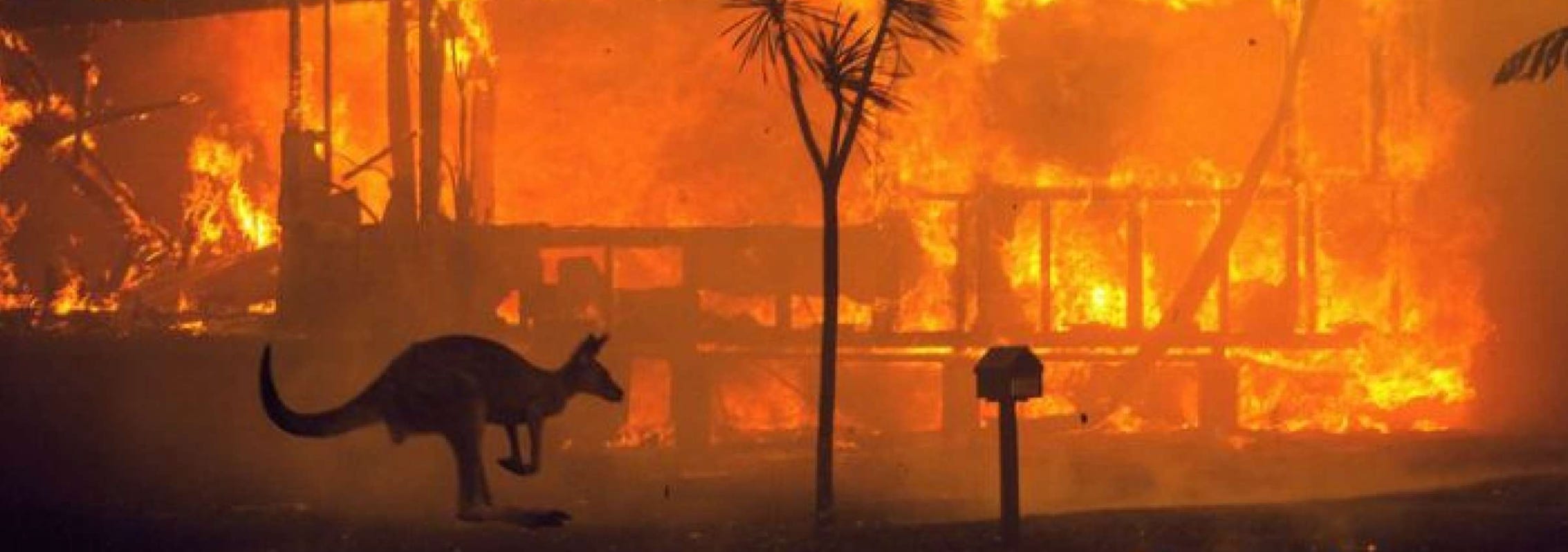
‘The massive geographic scale and severity of the 2019/2020 Black Summer bushfires form part of a confirmed trend of worsening fire weather and larger, more intense wildfires caused by climate change. It has sparked growing interest in building sustainability into fire risk management and the landscape.’ [source]